STEINHAGEN RESERVOIR
STEINHAGEN RESERVOIR890 Fm 92
(lat:30.8341 lon:-94.1872)

Phone:
409 429-3491
Steinhagen Reservoir, also known as B. A. Steinhagen Lake, is a reservoir in Southeast Texas created by the construction of the Dam B on the Neches River and Taylor's Bayou. The main feature of this water body is its role in providing flood control, hydroelectric power generation, water supply for industrial use and municipal needs.
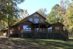
Spanning an area of approximately 10,687 acres with about 75 miles of shoreline when at full pool level (85 feet above mean sea level), it offers ample space for recreational activities such as boating and fishing. Opened to public use since December 1951 following completion by U.S Army Corps Engineers Galveston District; it has become a popular destination not only for locals but tourists seeking outdoor adventure amidst natural settings.
The Steinhagen Reservoir, also known as B.A. Steinhagen Lake, is situated in Southeast Texas near the borders of Jasper and Tyler counties. This man-made reservoir was created by damming the Neches River with the construction of Town Bluff Dam for flood control purposes and water supply needs. The surrounding geography features a blend of East Texas Piney Woods characterized by dense forests composed mainly of pine trees interspersed with hardwoods such as oaks and hickories; it transitions into wetlands along riverbanks that provide habitats for diverse wildlife species including alligators, numerous bird varieties, fish populations, and other aquatic organisms typical to this subtropical region's ecosystem. Flat to gently rolling terrain predominates around the lake area which offers recreational opportunities like boating, fishing (especially catfish), camping at designated parks maintained by U.S Army Corps Engineers or private campgrounds nearby while contributing significantly towards local tourism economies within an otherwise rural landscape dominated primarily through timber production alongside some agriculture activities further inland away from immediate waterfront zones.
Constructed in 1951-1953 for flood control, water supply, and recreation purposes, the body of water known as B.A. Steinhagen Lake is impounded by the Town Bluff Dam on the Neches River. The U.S. Army Corps of Engineers owns and operates both structures.
Before its current recreational use, surrounding lands primarily supported agriculture and timber production activities typical to East Texas's Piney Woods region.
Ownership has remained with federal authorities since dam construction; however local communities have historically utilized adjacent areas for economic sustenance through farming practices before inundation occurred due to reservoir creation.
Within what is now Martin Dies Jr State Park along its shores are historical features such as remnants from early settler homesteads dating back to when European descendants first colonized this area during westward expansion periods in American history.


 Share Your Steinhagen Reservoir Photos (click here)